| 1.
|
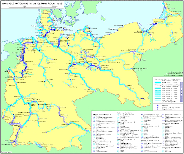
Navigable Waterways in the German Reich (1903)
Between 1875 and 1914, the total length of navigable waterways in the German Reich doubled. Rapid industrialization and an explosion in economic growth, particularly after unification in 1871, led....
|
|
| 2.
|
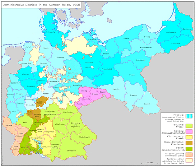
Administrative Districts in the German Reich (1905)
In the German Empire [Reich], different federal states had different administrative structures. Within this framework, Prussian provinces enjoyed the highest degree of administrative sovereignty.....
|
|
| 3.
|
Germany and Europe in the First World War (1914-1918)
During the First World War, the Central Powers (Germany, Austria-Hungary, and, as of November 1914, the Ottoman Empire) and the Entente Powers (France, Russia, and Great Britain) stood in hostile....
|

|


 return to list