GHDI logo


States of the Federal Republic (2003)

After the new states joined the Federal Republic, some small adjustments to their borders were made – for example, the border between Saxony and Thuringia was altered. Although these changes are reflected on the map, they are small enough in some cases to be barely noticeable. This map shows the sixteen states of the Federal Republic as they are today.

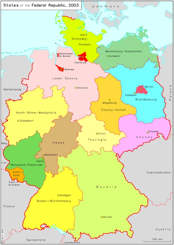
Please click on print version (below) for a larger version with enhanced resolution.

print version     return to map list previous map      next map

States of the Federal Republic (2003)

IEG-Maps, Institute of European History, Mainz / © A. Kunz, 2004