| 1.
|
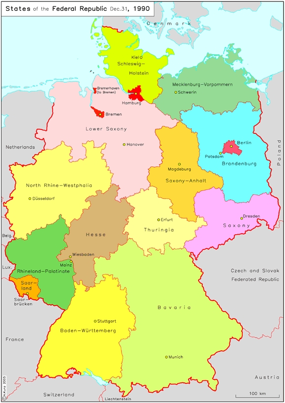
States of the Federal Republic (December 31, 1990)
This map shows the federal structure of the Federal Republic of Germany after unification. On October 3, 1990, five “new” states – Mecklenburg-Vorpommern (capital: Schwerin), Brandenburg (Potsdam),....
|
|
| 2.
|
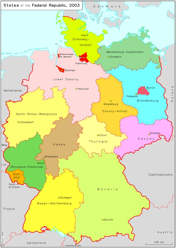
States of the Federal Republic (2003)
After the new states joined the Federal Republic, some small adjustments to their borders were made – for example, the border between Saxony and Thuringia was altered. Although these changes are....
|
|
| 3.
|
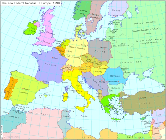
The New Federal Republic in Europe (1990)
With an area of approximately 360,000 square kilometers (ca. 139,000 square miles), unified Germany is one Europe’s largest states in terms of territory; with around 82 million inhabitants, it is....
|
|
| 4.
|
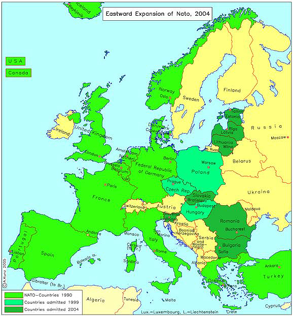
NATO's Eastward Expansion (2004)
The end of Germany’s division gave Europe an impetus to overcome the larger division between East and West. This map shows the expansion of NATO, formerly a Western defense system, into Central and....
|
|


 return to list