|
Occupation Zones and States (1947)
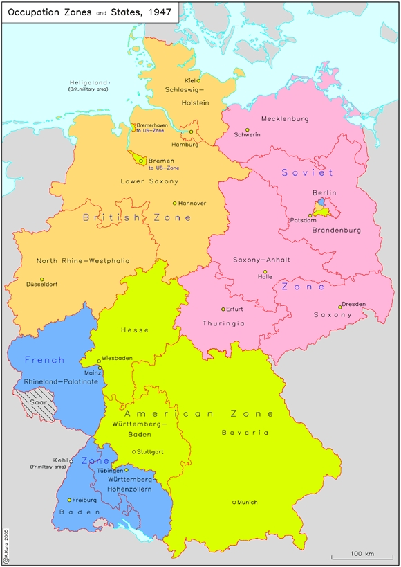
In this map, the states [Länder] are delineated, and the Zones of Occupation have been added in color. This helps show that the existing Zones of Occupation contributed to the difficulties involved in founding states. This was especially true in southwestern Germany, where French and American interests and plans clashed. But, as one clearly sees, the borders of the new state of Rhineland-Palatinate, created out the French Zone of Occupation, followed the "zonal" borders in the north and the east. The same is true for the borders of the new states in northern and central Germany, which were marked by the border between the British (and, respectively, American) and the Soviet Zones of Occupation. (A. Kunz) Please click on print version (below) for a larger version with enhanced resolution.
IEG-Maps, Institute of European History, Mainz / © A. Kunz, 2005
|


 print version
 return to map list
 previous map