

INTRODUCTION | DOCUMENTS | IMAGES | MAPS | EDITOR
|
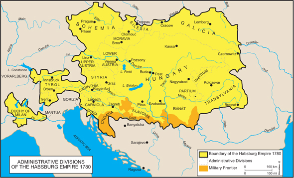
Please click on print version (below) for a larger version with enhanced resolution.
Cartography by Mapping Solutions, Alaska, 2010. |
 print version
 return to map list
 previous map